
Download Either Version Of Our Free Bike Crash App
Available on iPhone
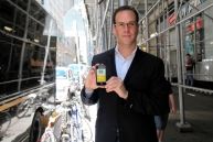
To demonstrate our commitment to New York's cycling community, we have released what we believe to be New York's first Bike Crash App. THE BIKE CRASH KIT is available for FREE in the iTunes App Store, so download it now! The application assists cyclists in gathering all necessary data after a crash. This includes the driver and vehicle owner's name, insurance information , witness information, responding police officer's name.
Blogs
- April, 2013- Understanding your bicycle damage claim
- May, 2013- Understanding No-Fault in New York
- June, 2013- What to do if you are in a Citi-Bike Crash
- July-August, 2013 - Sherriff gets it dead wrong
- Jan. 2015 Hit and Run and Underinsured (SUM) Claims in NY
- Feb. 2015 - Bike Crashes Involving Street Defects and Potholes
- July, 2015 - A Compilation of Bike Laws in NY State and NYC
- Nov. 2015 - Why you need to stay off Facebook after a crash
- March 2016 - New York is ready for a 3 foot law!

OVER 3000 FREE DOWNLOADS TO DATE!
It will also geo-tag the collision location, assist in taking photos of the accident scene and vehicles , record witness statements, and offer a sketch pad to diagram vehicle and cycle movement before and after the crash. If the collision involves a vehicle blocking a bike lane, or occurs as a result of a street defect such as a pothole, defective manhole cover, or grating, this defect can be documented by photo or sketch.
It is also our goal to allow this application to be used by advocacy groups to collect crash data in an organized format that can be easily e-mailed to crash stat, the NYPD, 311, or other organizations collecting data on bike and cycle crashes. This app furthers our goal to help promote bike safety and education on the rights and laws afforded to protect New York's cyclists. The application is now available on Apple platforms!

Why Choose Flanzig & Flanzig, LLP?
-
Leaders in the Safe Streets Movement
-
Committed Advocates for New York Cyclists
-
Top-Rated New York Attorneys
-
Dedicated to Helping Cyclists
-
Free Consultations
